2020 Louisiana Teacher of the Year & National Teacher of the Year Finalist
50 Historic Photos of St. Bernard Parish
They are somewhat in chronological order by date taken. Hope you enjoy these as much as I did:
De la Ronde Plantation, Chalmette, 1866. The site where General Pakenham allegedly took his last breath during the Battle of New Orleans. Source: Wiki Commons
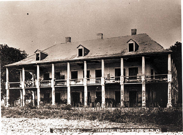
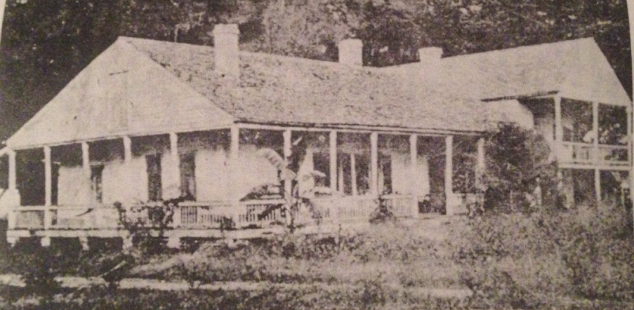
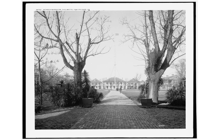
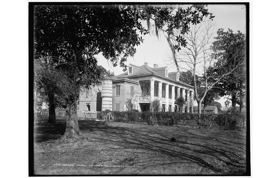
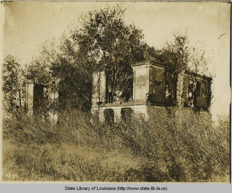
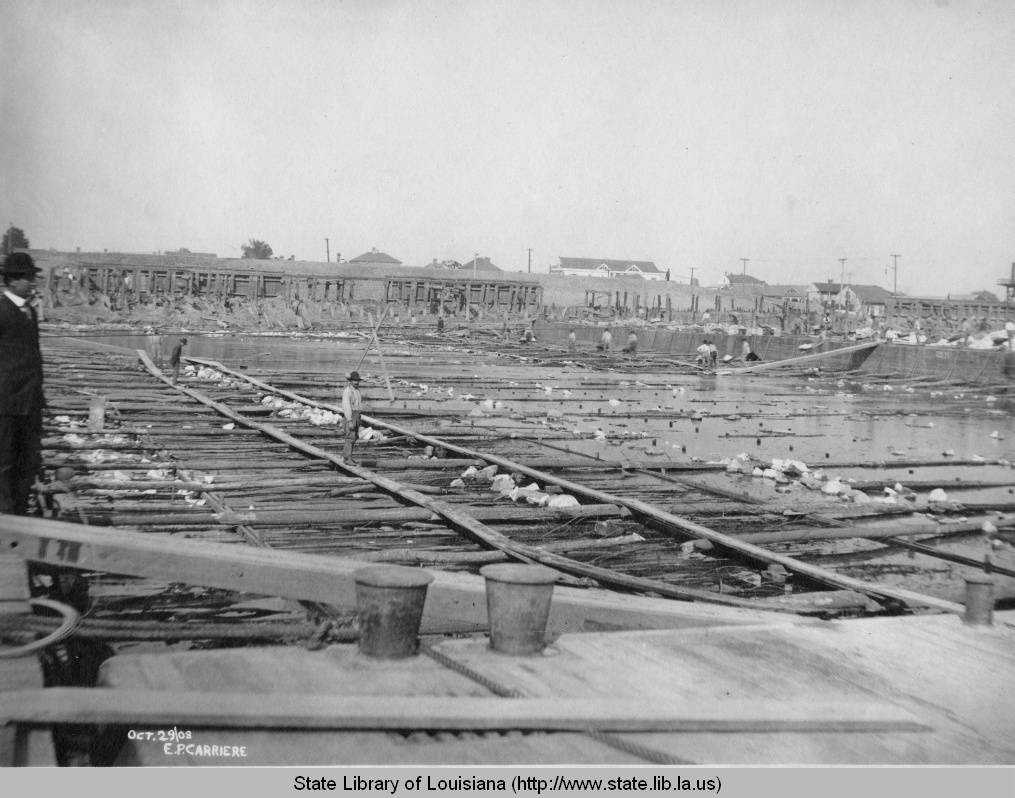
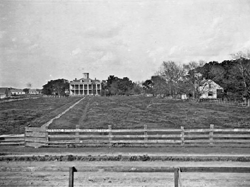
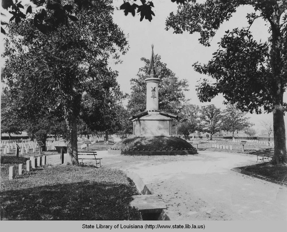
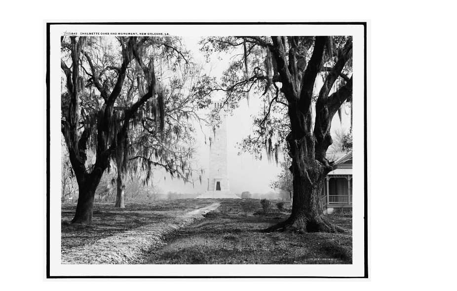
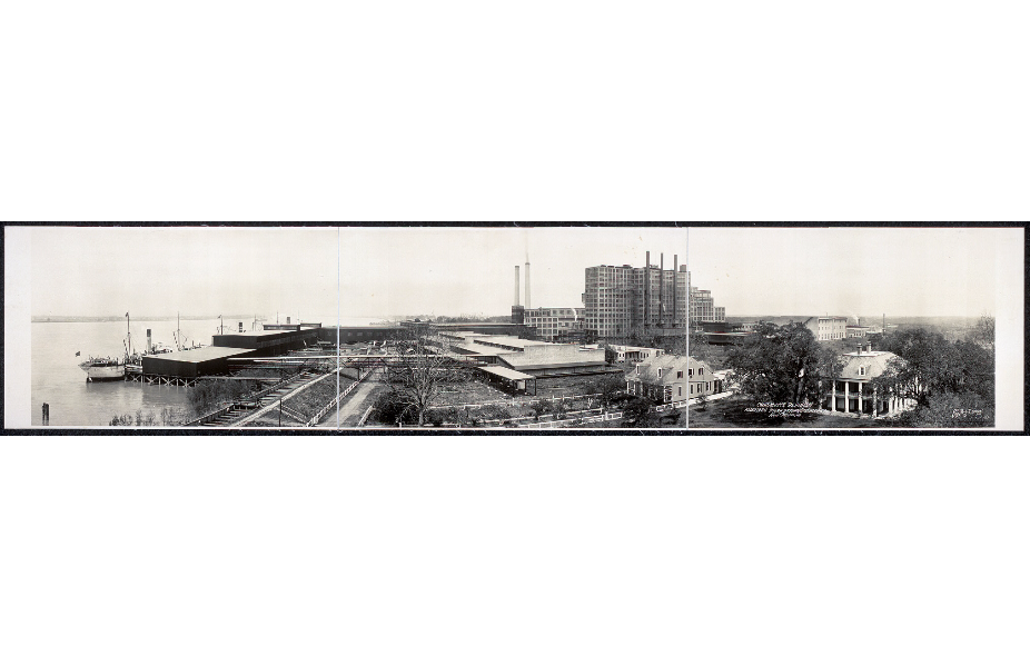
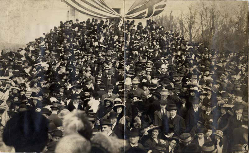
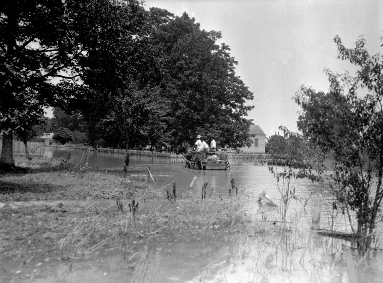
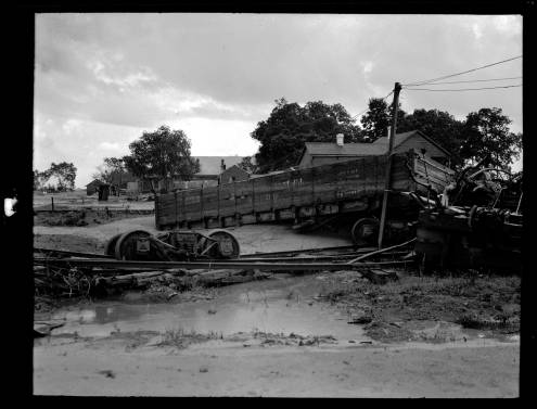
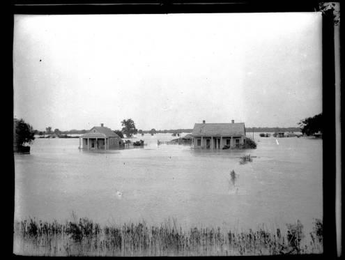
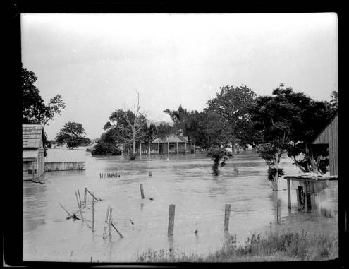
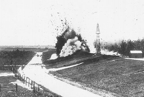
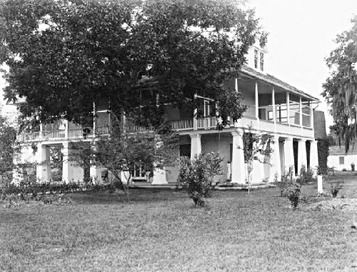
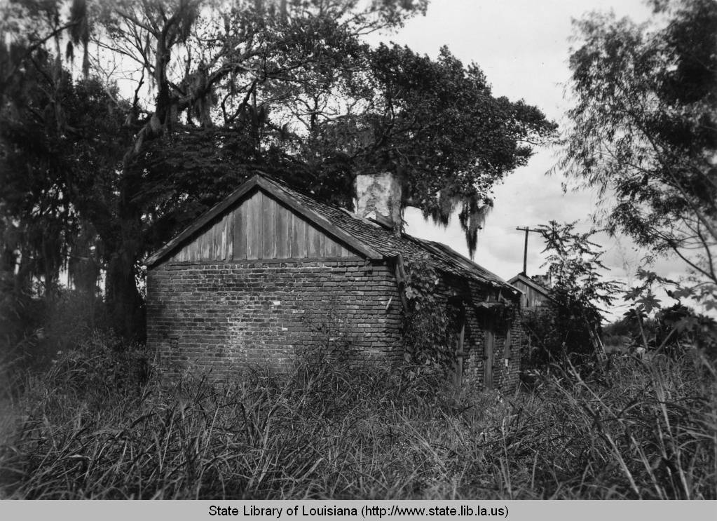
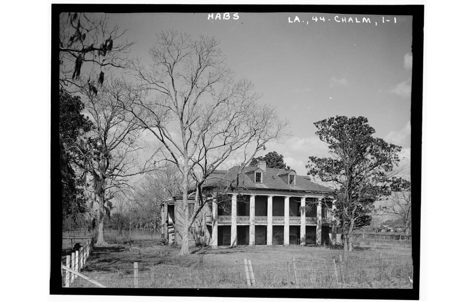
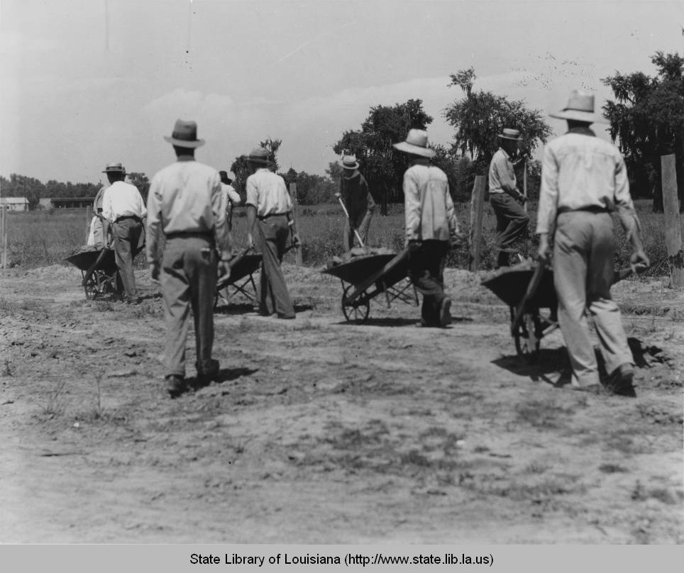
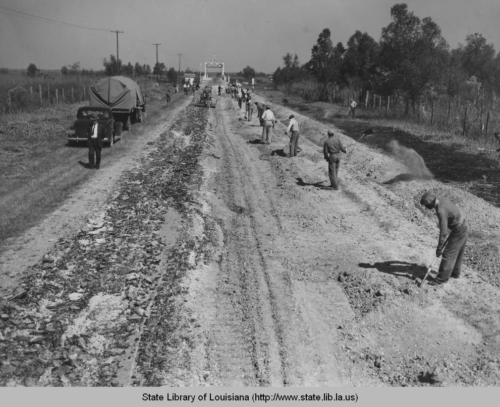
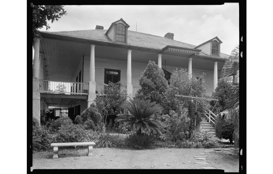
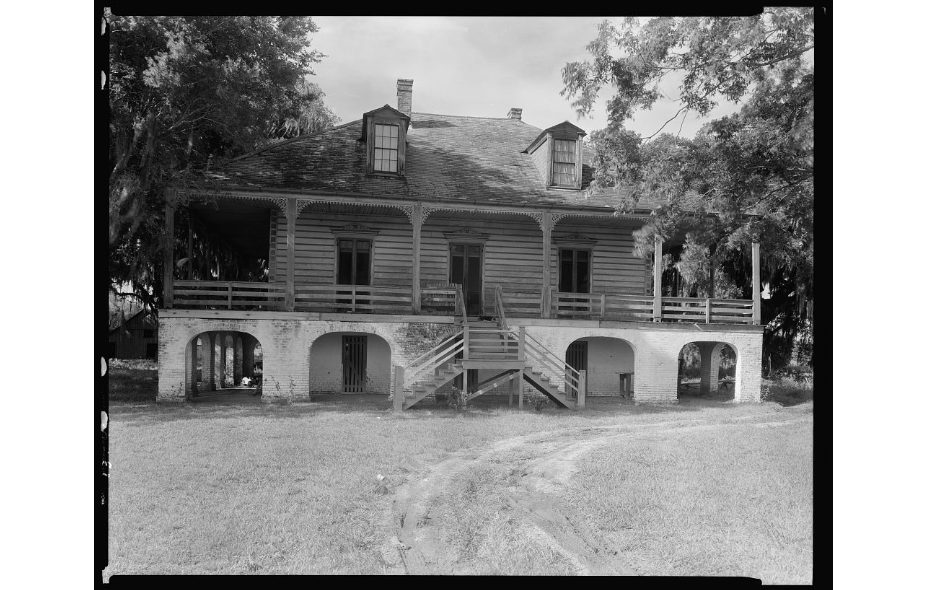
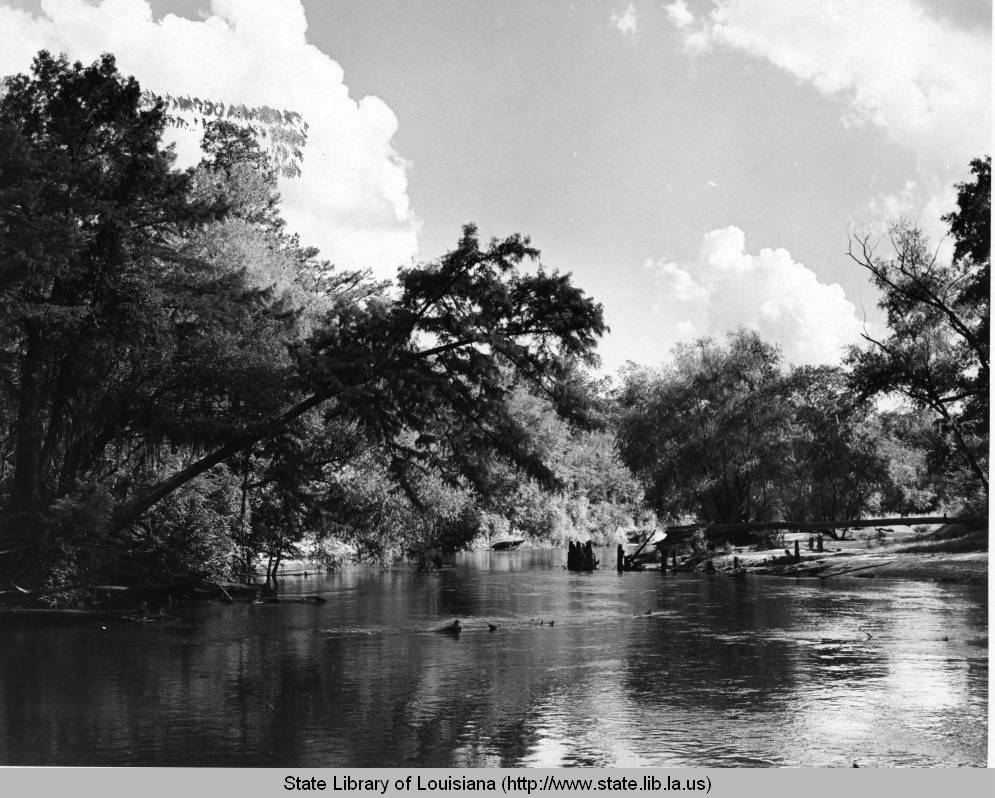
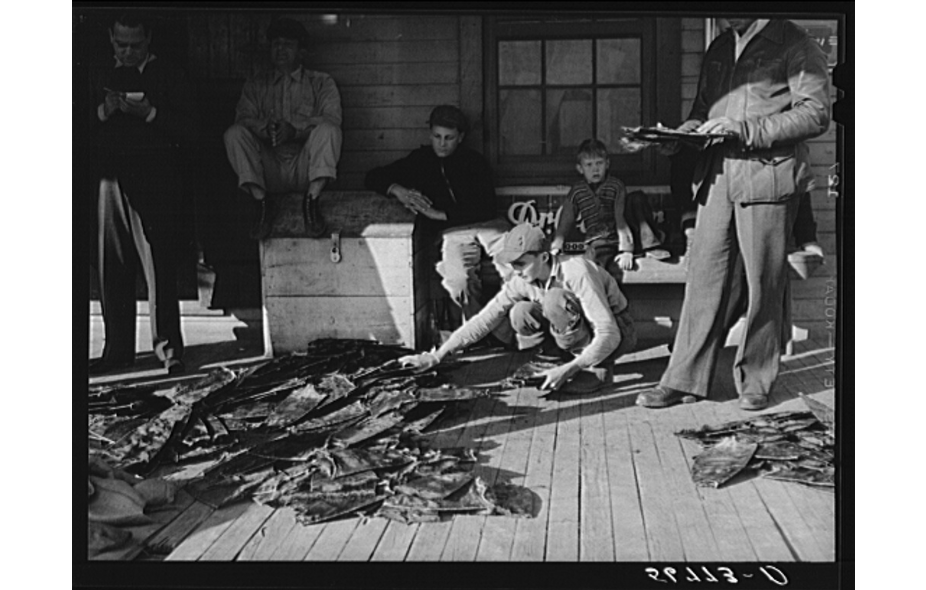
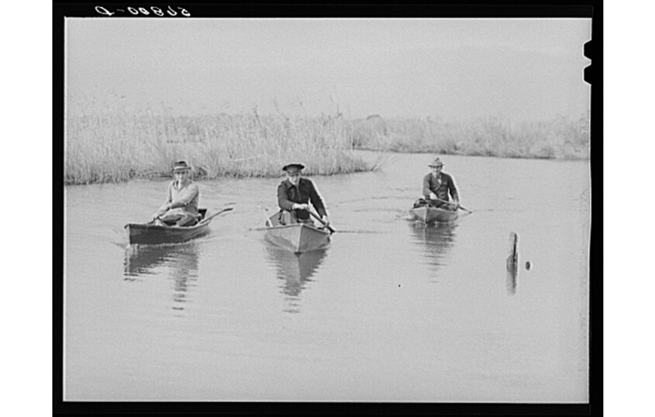
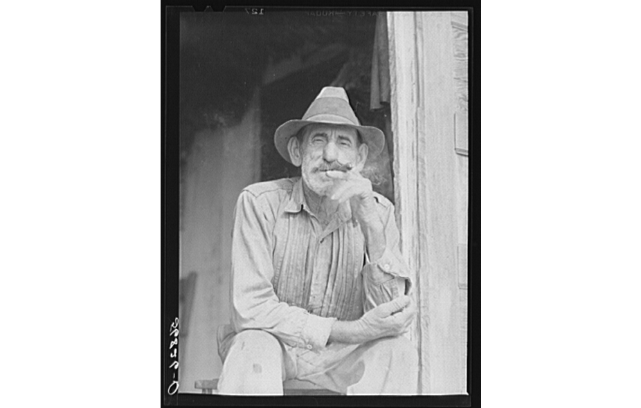
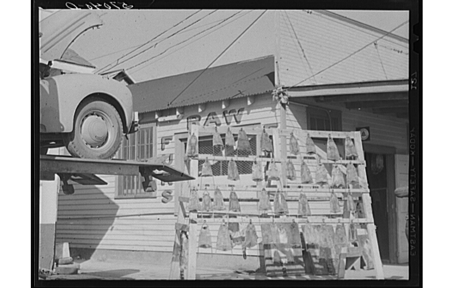
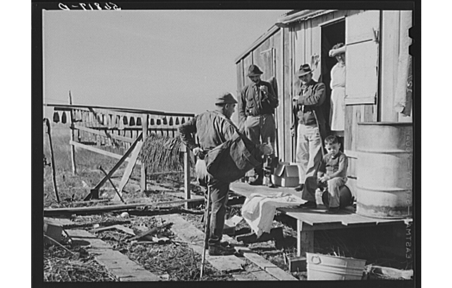
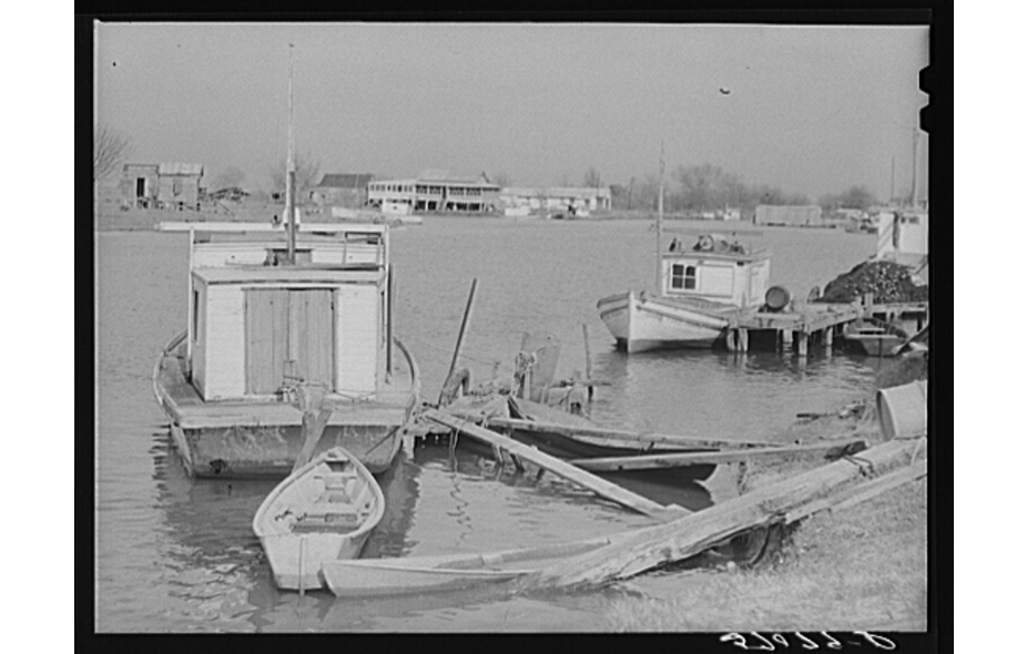
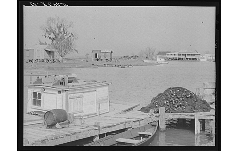
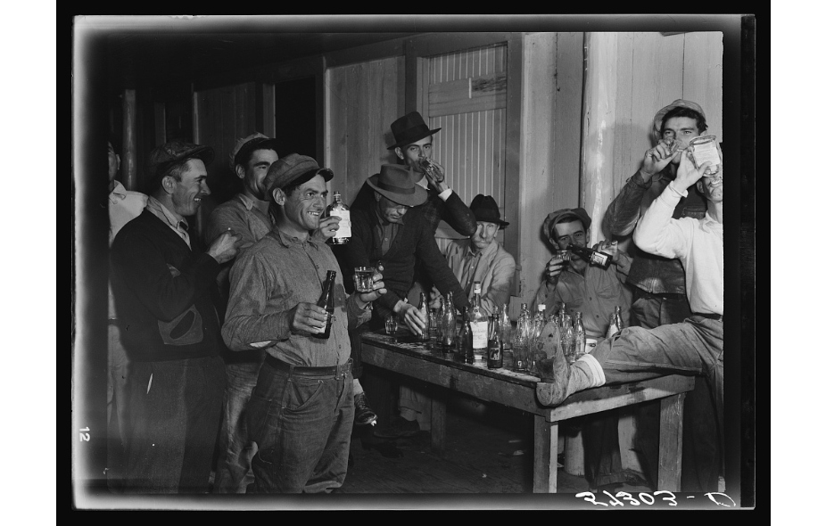
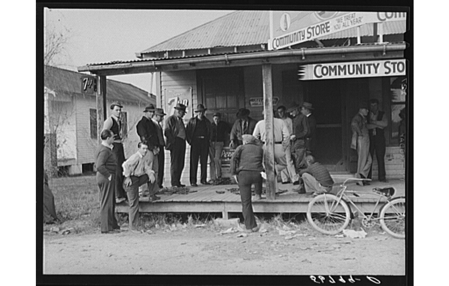
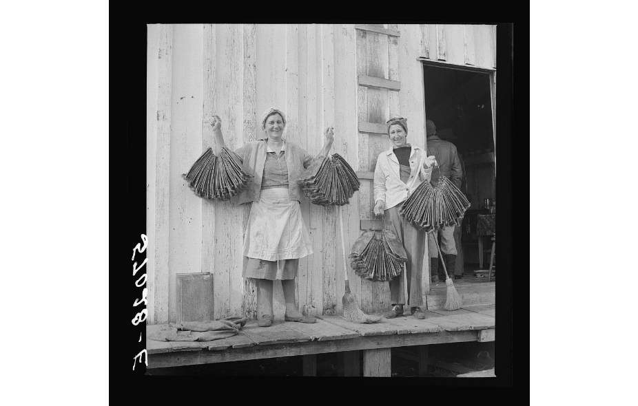
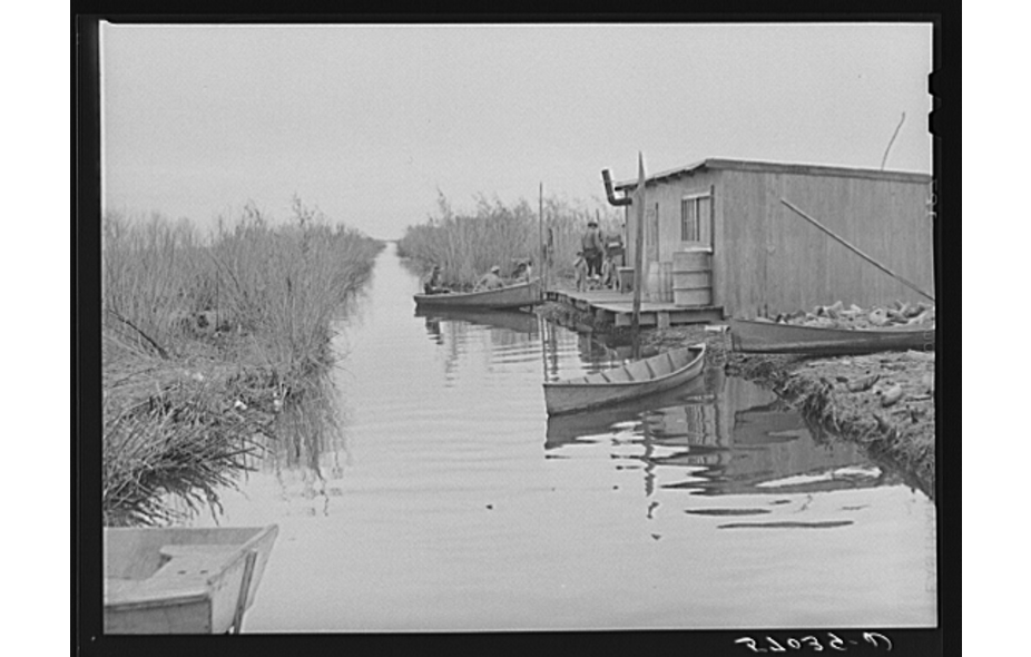
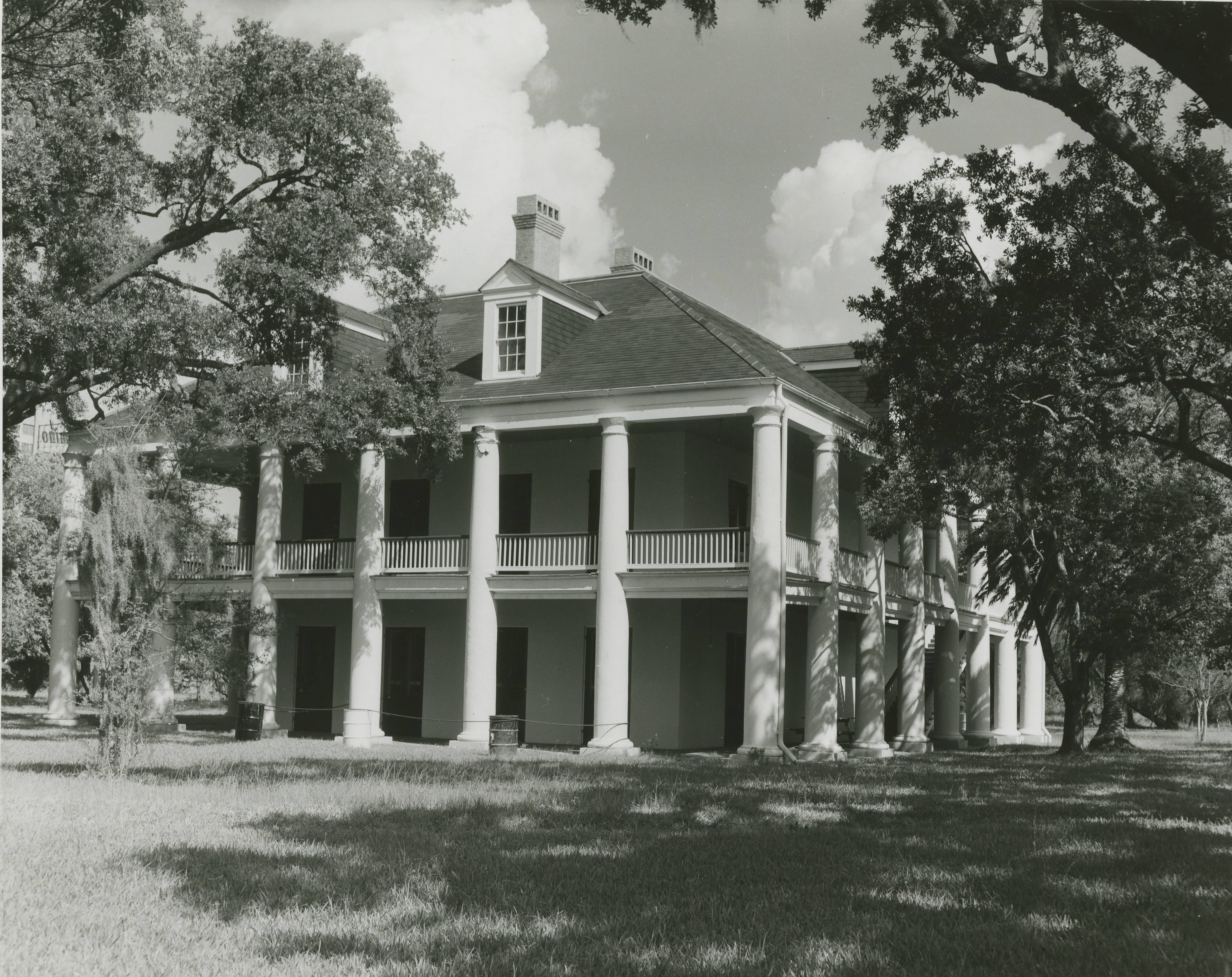
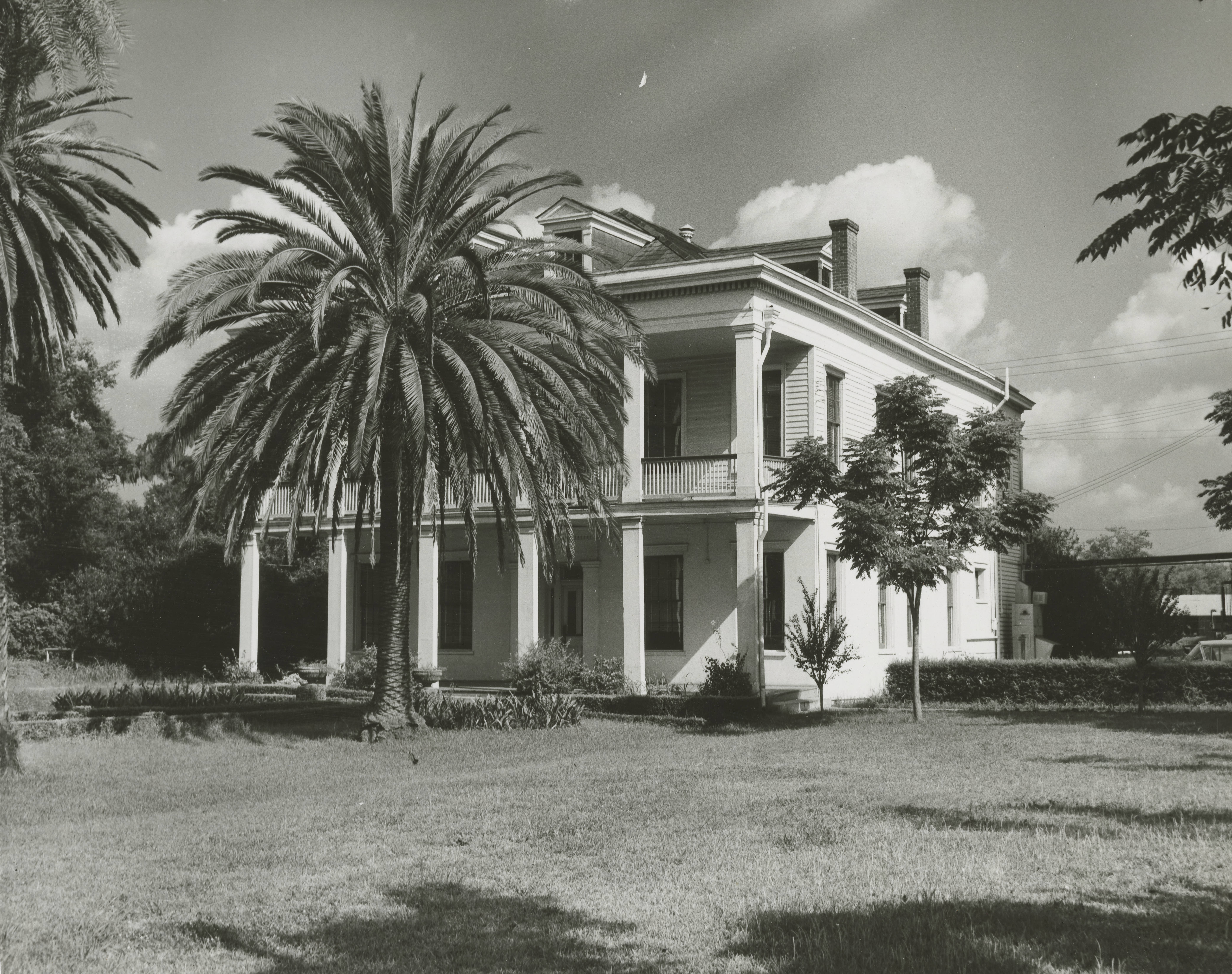
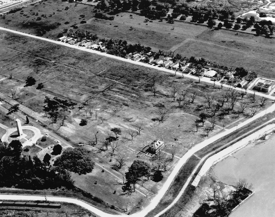
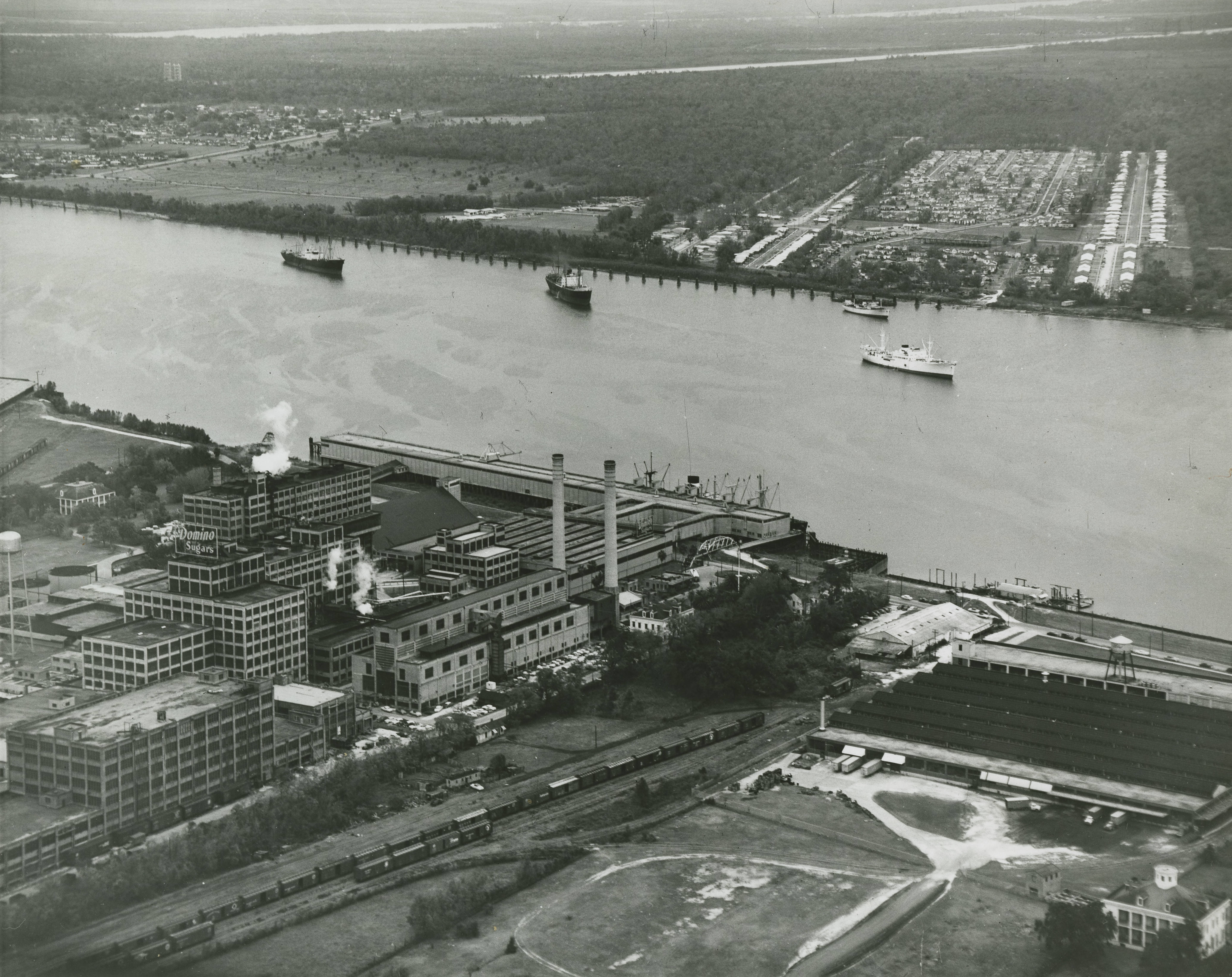
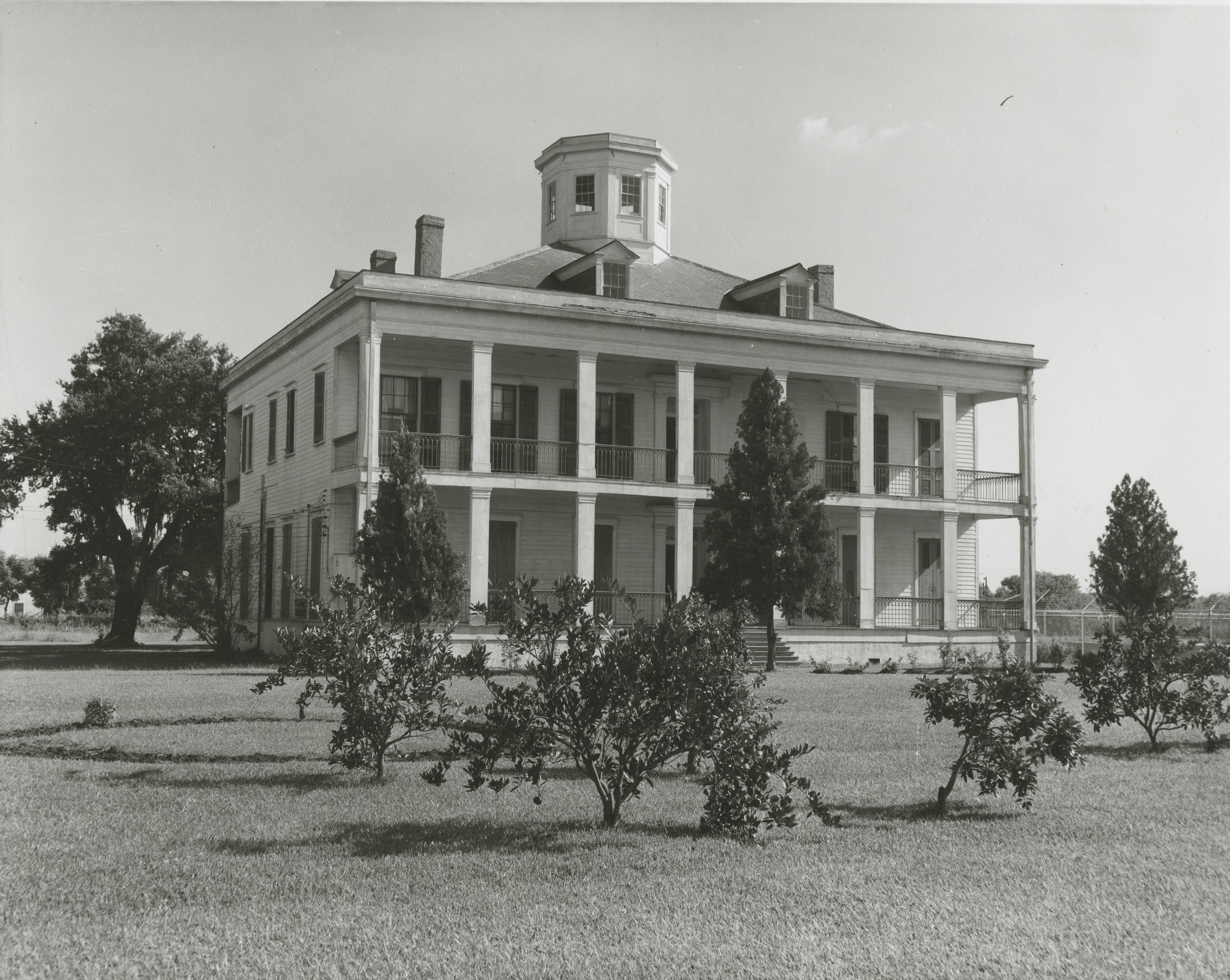
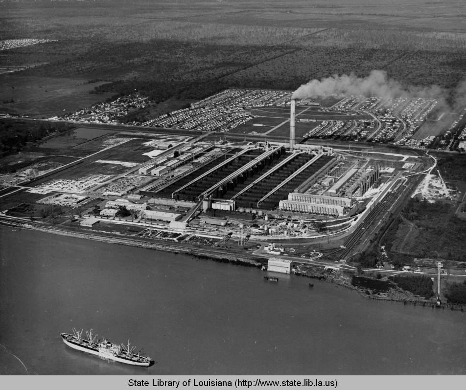
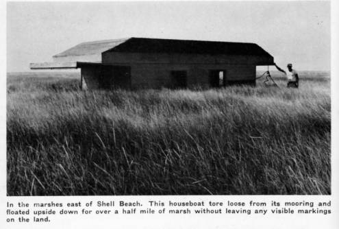
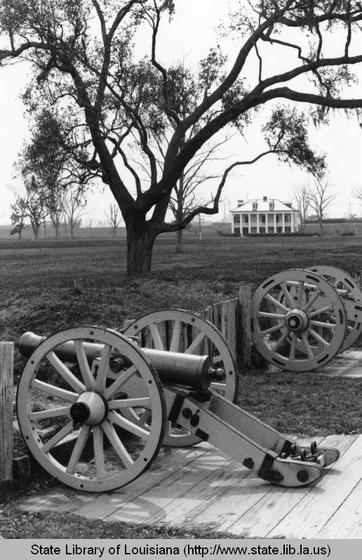
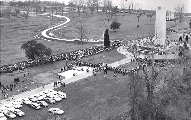
Villere Plantation, Chalmette, late 1890s. Home to Jacques Villere, first Creole governor of Louisiana. His home was occupied by the British during the Battle of New Orleans.Jackson Barracks, 1890s. (Close enough to the parish). Source: Library of CongressMalus-Beauregard House, late 1890s. Source: Library of Congress.De la Ronde ruins, date unknown. This was taken after 1877, which was the year the majority of it burned. Source: Louisiana Digital LibraryImproving levees in Poydras, 1908. Source: Louisiana Digital LibraryLebeau Plantation, Old Arabi, 1910. The plantation eventually burned down in 2013. Source: oldneworleans.comChalmette National Cemetery, 1910. Source: Louisiana Digital LibraryChalmette Monument, 1910s. Source: Library of CongressDomino Sugar Refinery, 1913. Source: Library of CongressCentennial at Chalmette Monument, 1915. Source: Louisiana Digital LibraryFlooding in Toca, 1922. Source: Wiki CommonsFlood damage in Poydras, 1922. Source: Louisiana Digital LibraryFlooding in Violet, 1922. Source: Louisiana Digital LibraryFlooding in lower part of the parish, 1922. Source: Louisiana Digital LibraryPakenham Oaks, 1920s. Source: Louisiana Digital LibraryLevees blown at Caernarvon during the Mississippi River Flood of 1927. Source: The Jesse Earl Hyde Collection, Case Western Reserve University (cwru) Department of Geological SciencesKenilworth Plantation, early 1930s. Source: oldneworleans.comMan working outside old slave quarters in Violet, 1930s. Source: Louisiana Digital LibraryOld slave quarters in Violet, 1930s. Source: Louisiana Digital LibraryFarmer with horse and goods in Terre-aux-Boeufs, date unknown. Source: Louisiana Digital LibraryRemnants of Villere Plantation, 1930s. Source: Louisiana Digital LibraryMemorial at the pet cemetery in Toca, late 1930s.Beauregard House, 1934. Source: Library of CongressBuildings roads in Old Arabi, 1936. Source: Louisiana Digital LibraryWorking on highway project, 1936. Source: Louisiana Digital LibraryChateau des Fleurs, Old Arabi, 1938. Source: Library of CongressLacoste Plantation, 1938. Source: Library of CongressWhiskey Bayou, date unknown. One of the many routes used to illegally import alcohol during Prohibition. Source: Louisiana Digital LibrarySelling and trading fur at the Community Store in St. Bernard Village, 1941. According to Dr. William Hyland, the St. Bernard Parish historian, the Community Store “is still standing and was purchased by Albert and Gerri Avenel in 1985 after Hurricane Juan flooded their former Delacroix Island home.” Source: Library of CongressManeuvering pirogues in Delacroix, 1941. Source: Library of CongressRaphael “Tio Phael” Robin, Isleño trapper, taking a cigar break, Delacroix, 1941. According to Dr. Hyland, he was a “very colorful and well remembered by his family in the 1980s. He was illiterate, but nevertheless a master of the marshes and waterways in Eastern St. Bernard Parish. He was a kind and benevolent patriarch of his family.” Source: Library of CongressMuskrat skins for sale, Delacroix, 1941. Source: Library of CongressTrappers’ house in Delacroix, 1941. Source: Library of CongressDelacroix Isle, 1941. Source: Library of CongressDelacroix Isle, 1941. Source: Library of CongressIsleños drinking and gambling, Delacroix, 1941. Source: Library of CongressTrading furs in Delacroix, 1941. Source: Library of CongressAccording to Dr. Hyland, ” Maria Robin Lopez holding animal pelts, smiling on the left and her sister, “Chica” on the right. “Maria Mamerto” as she was known was famous for her delicious stuffed crabs and quick wit! She married “Mamerto” Lopez, a Spanish-Basque refugee from the civil wars in Spain. He was a mirror image of an Ernest Hemingway character.” 1941. Source: Library of CongressDelacroix Isle, 1941. Source: Library of CongressThree Oaks Plantation, 1940s. Destroyed in 1966 by Domino Sugar Refinery. Source: Louisiana Digital LibraryDarcentel-Cavaroc House, Old Arabi, early 1950s. Source: Louisiana Digital LibraryFazendeville and the Chalmette Monument, late 1950s. Fazendeville, a community of color started by a freedman in 1866, was demolished in 1966 by the National Park Service. Courtesy of the Louisiana Air National Guard, c. 1960Domino Sugar Refinery, presumably 1950s. Lebeau Plantation in lower right corner. Source: Louisiana Digital LibraryLebeau Plantation, date unknown. Source: Louisiana Digital LibraryKaiser Aluminum Plant, Chalmette, 1950s. My grandfather was working there at the time. Source: Louisiana Digital LibraryUpside houseboat in Shell Beach, 1955. Source: Louisiana Digital LibraryBeauregard House at Chalmette Battlefield, 1960s. Source: Louisiana Digital LibraryChalmette Monument, 1960s. Source: Louisiana Digital LibraryBattle of New Orleans sesquicentennial at Chalmette Monument, 1965. Fazendeville in the background. Source: NPS
If you think any photos should have been included that are not please send them or post them in the comments. If you have any questions on anything, such as the photographers who took them, the exact locations of buildings no longer there, etc., ask away and I may be able to help.
Update: With the meticulous help of the resourceful Dr. William Hyland, the St. Bernard Parish historian, some of these photos have been expanded on and/or correctly identified.
2020 Louisiana State Teacher of the Year & Author of “The 1868 St. Bernard Parish Massacre: Blood in the Cane Fields,” The History Press
View all posts by Chris Dier
Thank you for collecting and sharing all of these wonderful images. The photos and comments have been very helpful to me on my quest to learn more about St. Bernard Parish.
A wonderful collection of photos,etc.! Can you tell me, Chris, why did so many of the plantations, which were often brick, burn down? I thought brick was basically fireproof. Is it because our brick here is not that solid, because it is often made of clay and horsehair/Spanish Moss? “Sugar brick,” as I have heard guides call it? Or is it because so much of the house is still wooden, that the burned-out interior destabilizes it?
Back in the 1950’s when I was young My we would visit my aunt in Poydras and I remember going through this beautiful canopy of trees. My dad wad born in 1917 and grew up in St Bernard parish. and I seem to remember the run down Plantation home was still visible from the St Bernard Hwy, ( Now this was close to 65 years ago so memory is a little sketchy today. But my dad said it got a nicknamed when he was young “The Murder Mansion” Some about rumors of someone’s wife was murdered there ? well the owner of the property looking ago was According to St. Bernard Parish historian Bill Hyland, the 700-acre Docville Farm, off St. Bernard Highway, stretches from the Mississippi River levee all the way to Lake Borgne. The property is the former estate of legendary St. Bernard Parish Sheriff Louis A. “Doc” Meraux, the father of Joseph Meraux, a banker, prominent landowner and the namesake of the Joseph and Arlene Meraux. Now it is a place of interest and the center of the Docville Farm Foundation which has a learning center and is supposed to be a nice place to visit. Again I cannot guarantee that this information is truly accurate as it is just what was handed down to me when I was young and had family down in St Bernard Parish.
I really enjoyed this page Chris. I was in the area last week again as I had just found out a few weeks prior that the Lebeau Plantation had burned! Luckily, I took some close up photographs of this house in 2005 and after much search I found the photographs. I plan to put them online eventually in Omeka software / as I have been using this ‘museum software’ for history projects the last year in college. I will send you a few of the best photographs to see if you like as I tried to get the detail of the architecture and I haven’t seen that posted on the photographs online.
My friends, Toddie and Gator lived there. I think their last name was Bienvenue. They managed TAC Amusement which I think was owned by Carlos Marcelo. I loved Gator, he was a nice man to all of us, and we played the pin ball machines all over St. Bernard Parish.
Thanks for the informative webpage! I was unaware that Lebeau Plantation has burned. I took some great detailed photographs of the house in 2005 and plan to put them online in the next few months in Omeka software which I have been using for digital history projects. I would be happy to send a few of the best ones if you would to view them. Thanks again!
I am trying to find out if Millaudon Plantation or if any plantation was located where W. Smith Elementary School . I’m not sure where to start when lookng for this information.
Susan,
Unfortunately I don’t have or know of any photos but wanted to thank you for sharing your memory. LOVED Hayes ice cream! My Uncle who visited our family in Arabi often would stop there and bring 3 quarts of their chocolate, strawberry and frozen cream cheese ice cream. Still the standard for quality (for me) these nearly 60 years later.
The picture labelled “Working on highway project, 1936. Source: Louisiana Digital Library” appears to be Paris Rd. as remember crossing the bridge in the background at Bayou Bienvinue before the new 4 lane “elevated road” was built in the late 1970s.


Thank you for collecting and sharing all of these wonderful images. The photos and comments have been very helpful to me on my quest to learn more about St. Bernard Parish.
Why haven’t we identified LSU University campus on the site of the battlefield in the 1870s
A wonderful collection of photos,etc.! Can you tell me, Chris, why did so many of the plantations, which were often brick, burn down? I thought brick was basically fireproof. Is it because our brick here is not that solid, because it is often made of clay and horsehair/Spanish Moss? “Sugar brick,” as I have heard guides call it? Or is it because so much of the house is still wooden, that the burned-out interior destabilizes it?
What plantation were the slaves from in Violet? I grew up there. Lived in a shotgun house.
Back in the 1950’s when I was young My we would visit my aunt in Poydras and I remember going through this beautiful canopy of trees. My dad wad born in 1917 and grew up in St Bernard parish. and I seem to remember the run down Plantation home was still visible from the St Bernard Hwy, ( Now this was close to 65 years ago so memory is a little sketchy today. But my dad said it got a nicknamed when he was young “The Murder Mansion” Some about rumors of someone’s wife was murdered there ? well the owner of the property looking ago was According to St. Bernard Parish historian Bill Hyland, the 700-acre Docville Farm, off St. Bernard Highway, stretches from the Mississippi River levee all the way to Lake Borgne. The property is the former estate of legendary St. Bernard Parish Sheriff Louis A. “Doc” Meraux, the father of Joseph Meraux, a banker, prominent landowner and the namesake of the Joseph and Arlene Meraux. Now it is a place of interest and the center of the Docville Farm Foundation which has a learning center and is supposed to be a nice place to visit. Again I cannot guarantee that this information is truly accurate as it is just what was handed down to me when I was young and had family down in St Bernard Parish.
I really enjoyed this page Chris. I was in the area last week again as I had just found out a few weeks prior that the Lebeau Plantation had burned! Luckily, I took some close up photographs of this house in 2005 and after much search I found the photographs. I plan to put them online eventually in Omeka software / as I have been using this ‘museum software’ for history projects the last year in college. I will send you a few of the best photographs to see if you like as I tried to get the detail of the architecture and I haven’t seen that posted on the photographs online.
My friends, Toddie and Gator lived there. I think their last name was Bienvenue. They managed TAC Amusement which I think was owned by Carlos Marcelo. I loved Gator, he was a nice man to all of us, and we played the pin ball machines all over St. Bernard Parish.
Thanks for the informative webpage! I was unaware that Lebeau Plantation has burned. I took some great detailed photographs of the house in 2005 and plan to put them online in the next few months in Omeka software which I have been using for digital history projects. I would be happy to send a few of the best ones if you would to view them. Thanks again!
I am trying to find out if Millaudon Plantation or if any plantation was located where W. Smith Elementary School . I’m not sure where to start when lookng for this information.
I believe the Millaudon Plantation was located on the other side of St. Bernard Highway from W. Smith Elementary along the Mississippi River.
The Millaudon Plantation was on the Westbank of New Orleans, where the town Marrero La.
I am looking for photos of the Hayes Dairy/Ice Cream Parlor that was on St. Bernard Hwy in Arabi.
Susan,
Unfortunately I don’t have or know of any photos but wanted to thank you for sharing your memory. LOVED Hayes ice cream! My Uncle who visited our family in Arabi often would stop there and bring 3 quarts of their chocolate, strawberry and frozen cream cheese ice cream. Still the standard for quality (for me) these nearly 60 years later.
I looked, but did not see any photos/comments re the abattoirs where my families worked or about homes on Aycock St. where they all lived.
I lived in Chalmette and Mereaux
From 1952 through 2005. I miss home
I was hoping to see what we called the White House in Verrett. My In Laws lived there until Katrina.
The picture labelled “Working on highway project, 1936. Source: Louisiana Digital Library” appears to be Paris Rd. as remember crossing the bridge in the background at Bayou Bienvinue before the new 4 lane “elevated road” was built in the late 1970s.
I was told that there was a tunnel between Jackson Barracks and Chalmette Monument. Is there any truth to this?